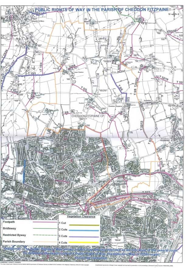
Please find below a map showing the Public Rights of Way for Cheddon Fitzpaine, and two Ordnance Survey (OS) maps of the village and the surrounding area. Click on the thumbnails to show the maps.
Where applicable images produced from the Ordnance Survey Get-a-map service. Images reproduced with kind permission of Ordnance Survey and Ordnance Survey of Northern Ireland.
Necessary cookies are absolutely essential for the website to function properly. This category only includes cookies that ensures basic functionalities and security features of the website. These cookies do not store any personal information.
Any cookies that may not be particularly necessary for the website to function and is used specifically to collect user personal data via analytics, ads, other embedded contents are termed as non-necessary cookies. It is mandatory to procure user consent prior to running these cookies on your website.